
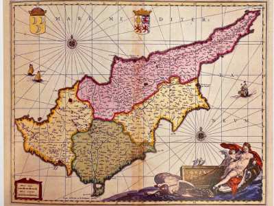
Upon its establishment in 1984, the Foundation acquired twenty-four printed maps of Cyprus, bequeathed by the Bank. Today, the Collection counts more than 400 maps and includes most of the known printed maps of Cyprus dated between the 16th and 20th centuries. It is a notable series that provides a detailed picture of the development of Cypriot cartography, the course of which is intertwined with the island’s turbulent history.
The Foundation's dedication to the collection, preservation, and public presentation of early maps has earned it global acclaim. Its efforts in promoting scholarly work on historical cartography were recognised in 1990 when it received an award from the prestigious International Map Collectors’ Society (IMCoS).
The Foundation's map collection has been enriched by significant donations. In 1988, the late Agnes Michaelides bequeathed the Michaelides Map Collection, a treasure trove of sixty-four items. This collection includes six 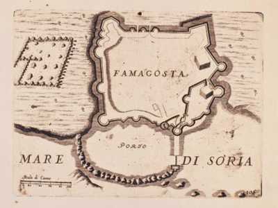 different tabulae from various editions of Claudius Ptolemy’s Geography, the earliest dating back to 1525, and the first accurate sea-charts of Famagusta harbour, the work of Thomas Graves, published in the second half of the 19th century. In 1993, Laura Georgiades decided to donate to the Cultural Foundation the map collection belonging to her late husband, Antonakis Georgiades, a collector and a founding member of the Cyprus Map Collectors’ Society. The collection comprises eighty-two items and includes a series of miniature maps of Cyprus originally published in pocket edition atlases of the 16th and 17th centuries.